“Italian Agricultural Regions Most Affected by Water Stress“
27th National Agrometeorology Conference
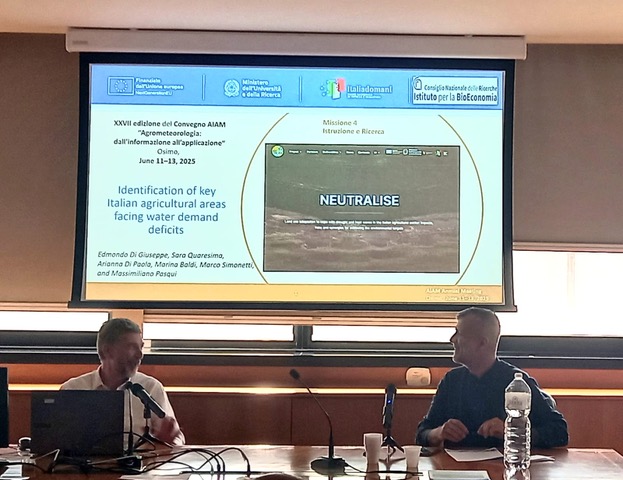
From June 11 to 13 in Osimo (AN), the 27th National Agrometeorology Conference was held, during which our colleagues from the Institute of Bioeconomy presented some preliminary results from the climatological analysis conducted within the NEUTRALISE project.
Here is the presentation of the talk: PPt_Ibe

“Drought and Land Use in Agriculture: Scenarios, Impacts and Adaptive Capacity“
Intermediate Results of the NEUTRALISE Project
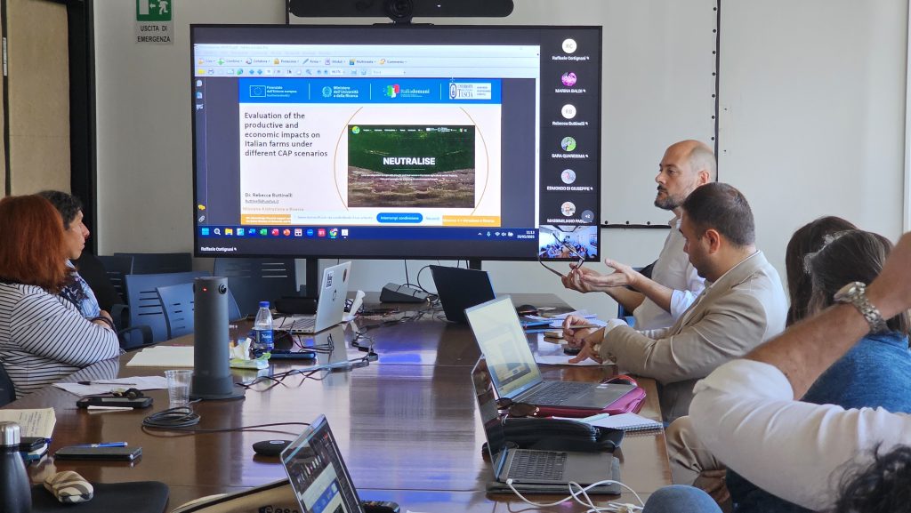
On May 28, 2025, at 10:00 AM, in the Golgi Room at the CNR headquarters (Piazzale Aldo Moro 7, Rome), the second event was held to present the NEUTRALISE Project: “Drought and Land Use in Agriculture: Scenarios, Impacts and Adaptation Strategies.”
Programme
10:00 AM – Opening Session
- Introduction to the NEUTRALISE Project: activities, objectives, and expected results
Raffaele Cortignani [UNITUS-DAFNE] - Climatological analysis of irrigation seasons across Italian agricultural regions
Arianna Di Paola, Edmondo Di Giuseppe, Marina Baldi, Massimiliano Pasqui [CNR-IBE] - Assessment of productive and economic impacts on Italian farms under different CAP scenarios
Rebecca Buttinelli, Raffaele Cortignani [UNITUS-DAFNE] - Evaluating the adaptive capacity to water stress in a sample of Italian farms: preliminary results from a Responsiveness Score-based approach
Simona Tarra, Antonio Zinilli, Giovanni Cerulli [CNR-IRCrES]
11:00 AM – Discussion and in-depth analysis with the participation of:
- Alessandra Pesce [CREA]
- Federica De Maria [CREA]
- Sonia Marongiu [CREA]
- Antonio Urbano [ANBI]
- Luigi Ledda [CONAF – Marche Polytechnic University]
Workshop among project participants and external researchers.

“Drought and Land Use in Agriculture: Scenarios, Impacts, and Adaptation Strategies.” Preliminary Results of the NEUTRALISE Project
On Wednesday, November 13, 2024, at 10:00 am, the first event dedicated to the presentation of the NEUTRALISE Project, “Drought and Land Use in Agriculture: Scenarios, Impacts, and Adaptation Strategies,” will take place at the Silvestri Room of the CNR in Piazzale Aldo Moro, 7, Rome.
Below is the morning program:
10:00 am
- Introduction to the NEUTRALISE Project: activities, objectives, and expected outcomes – Raffaele Cortignani, UNITUS-DAFNE (Download)
- Irrigation Volumes and Seasonal Weather Conditions: Challenges and Reflections on RICA Data Analysis – Arianna Di Paola, CNR-IBE (Download)
- Analysis of Drought in Relation to Italian Agriculture: Forty Years of Observations and Future Perspectives – Edmondo Di Giuseppe, CNR-IBE (Download)
- Economic Analysis Using RICA Data – Raffaele Cortignani, UNITUS-DAFNE (Download)
- Assessment of Productive and Economic Impacts on Italian Farms – Rebecca Buttinelli, UNITUS-DAFNE (Download)
- The Responsiveness Scores Model for Impact Driver Analysis – Antonio Zinilli, Simona Tarra, and Giovanni Cerulli, CNR-IRCrES (Download)
11:00 am Discussion and further insights with the participation of:
- Alessandra Pesce, CREA
- Alessandro Monteleone, CREA-Rural Network
- Sonia Marongiu, CREA
- Daniela Santori, ANBI
Followed by a workshop among project participants and external researchers.
LX SIDEA Conference – “From the Farm-To-Fork Strategy to the One-Health Approach. Solutions for the European Agricultural Model in Light of New Economic Scenarios”
Anacapri, September 15–17, 2024
Buttinelli R., Severini S., Cortignani R. (2024). Assessing the Impact of CAP 2023-2027 First Pillar Reform on Italian Arable Farms and Irrigated Crops
13th AIEAA Conference – “The Social Sustainability of European Agriculture Facing Old and New Challenges. Issues, Methods, and Policies”
Bari (Italy), June 20–21, 2024
Buttinelli R., Dono G., Cortignani R. (2024). Assessing the Impacts of Chemicals Reduction on Arable Farms through an Integrated Agro-Economic Model
187th Seminar of the European Association of Agricultural Economists (EAAE) – “Food System Transformation – Role of Research”
Frick, Switzerland, June 12–14, 2024
Buttinelli R., Dono G., Cortignani R. (2024). Assessing the Impacts of Chemicals Reduction on Arable Farms through an Integrated Agro-Economic Model
Webinar: “Remote Sensing for Ag development: from plot towards landscape scales”, Dr. Francelino Rodrigues, June 24, 2024, 11:30 AM
In relation to the activities connected with the projects:
- NEUTRALISE “Land use adaptation to cope with drought and heat waves in the Italian agricultural sector: impacts, risks, and synergies for achieving the environmental targets,” funded under PRIN 2022 PNRR
- ECOWHEATALY “Evaluation of policies for enhancing sustainable wheat production in Italy,” funded under PRIN 2022
We would like to inform you about the seminar/webinar titled: “Remote Sensing for Agricultural Development: From Plot to Landscape Scales,” presented by Dr. Francelino Rodrigues, PhD. It will be held on June 24th at 11:30 AM and can be attended online via this link:
Francelino Rodrigues is a Senior Scientist, expert in Digital Agriculture, Geospatial project management, Remote Sensing, Precision Agriculture, Decision Support Systems, and High-throughput field phenotyping.
Here is the abstract of the seminar:
Title: “Remote Sensing for Agricultural Development: From Plot to Landscape Scales”
Precision Agriculture (PA) and especially Remote Sensing (RS) technologies have become more affordable and popular in recent years. Cameras have become more compact and lighter, with improved spectral and spatial resolutions. The use of incoming light sensors allows for images to be automatically calibrated to surface reflectance on the fly, while the image processing software keeps getting faster and increasingly user-friendly. This progress has promoted many advancements in the application of unmanned aerial vehicles (UAVs) to agricultural research, for instance within the plant breeding industry for high throughput field phenotyping. Similarly, open-access satellite systems such as Sentinel-1 and 2, as well as those of private companies (e.g. Planet) make it now possible to use their data streams to regularly monitor crops and develop decision support tools for crop management. UAV and satellite-based remote sensing technologies have been increasingly used in agricultural research at different scales, from experimental plots on research stations to farmers’ fields and regional scales, bringing important synergies between both systems – often ignored. A few examples of R4D using RS technologies at different spatio-temporal scales for agricultural research, the development of decision support systems for farmers, and its business model are going to be presented aiming for comments and discussion.
Here is a brief biography of the speaker:
Francelino has been working in Precision Agriculture and Remote Sensing since 2004, including his MSc, PhD, and Postdoctoral studies. During his scientific trajectory, he obtained experience with geospatial technologies in contrasting agricultural systems (coffee, sugarcane, cereals, and lately, livestock pasture-based systems) in a range of countries from different continents (Latin America, South Asia, East Africa, and Oceania), working at different spatio-temporal scales – from plot experiments to small and commercial farms’ systems and regional scales. His research focuses on the analysis and interpretation of spatial and temporal agricultural data sets, built up by the use of proximal and remote sensing technologies. He has extensively used different sensing technologies for field surveys retrieving biophysical and biochemical vegetative and soil traits, enabling scalable high-throughput field phenotyping for fostering the development of decision support systems for stakeholders and end-users from different primary industries. LinkedIn

